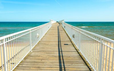
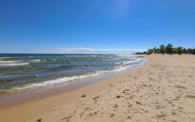
summer fun | winter fun | members login | contact us
 
Oscoda Snowmobile, Michigan Winter Vacation

 WINTER FUN


SNOWMOBILING

Oscoda is the eastern gateway to northern Michigan's snowmobile trail system. From here you can travel across the state to Traverse City or northward to the Upper Peninsula. The staging area is located on Grass Lake Road just south of River Road. In Footesite Village, six and a half miles west of the trailhead, riders will find food, beverages and fuel. There the trail divides and riders have options of heading north via Rea Road across the AuSable River and connecting with the Alcona County trail system. 

CROSS COUNTRY SKIING

The area has become a prime destination for cross-country skiers. Oscoda's location is ideally situated amidst a great selection of trail lengths and conditions to appeal to all levels of skiers.


Corsair Ski Trails

In Oscoda, the Corsair Ski Trails are nestled in the beautiful Silver Valley area, surrounded by the 120,000 acre Huron National Forest. The Corsair system is one of the largest groomed trail networks in Michigan. The 56 kilometers of interconnecting trails cross forest and meadows, hills and valleys. They take you through sunny open vistas, into hushed stands of sweet-smelling fir and towering hardwoods, and along the edge of winding ice-locked streams. The Corsair Trail Council operates and maintains the Corsair Skiing and Hiking Trail and the Highbanks Trails (both are located in the Huron National Forest).

The Corsair System offers 44 miles of groomed and tracked trails over a variety of terrain from level to somewhat hilly. Trails are signed for one-way traffic. No fees are charged, but donations are appreciated. Located about three miles south of River Road on Monument Road. There are three parking areas, one on the west and two on the east side of Monument Road.

Eagle Run is located two miles west of Oscoda on River Road. The trail runs along the banks of the AuSable River in the Huron National Forest, through mixed hardwoods and pines. The trail consists of 11 miles of groomed loops of varying lengths and difficulty. Trails are 13 feet wide and double packed. Ample parking is available.


Further west on River Road is the High Banks Cross Country Ski Trail. This is a linear trail, covering 14 miles of scenic AuSable River bluff, running from Iargo Springs on the west past Lumberman's Monument to Sid Town. This back-country trail is marked but not groomed, and is suitable for novice to intermediate skiers.

Hoist Lakes trails have been designated with the more experienced skier in mind. Longer loops and steeper hills offer an exciting challenge in beautiful surroundings. The trailhead is six miles north of Glennie on the west side of M-65 where parking is available.

Reid Lake offers six miles of gently rolling trails through an area of many ponds where you can easily find evidence of beaver activity. Parking lot is plowed but the trails are not groomed. The parking area and trailhead are located on the south side of M-72 across from Kohler Road. From Oscoda, follow F-41 north to M-72. Turn west and go 12.5 miles.

Snowmobile Map for Oscoda
Oscoda Trails
Oscoda Snowmobile Trails, Oscoda Snowmobile, Oscoda Family Vacation, Oscoda Winter Getaway
Eagle Run X-Country Trail Map
Oscoda, Eagle Cross Country Trail Map, Michigan Vacation Getaway
Highbanks Trail System
Highbanks Trail System, Oscoda Highbanks, Oscoda Cross Counrty Skiing
Hoist Lakes Trail Map
Hoist Lakes Trail Mao, Oscoda, Michigan Vacation Getaway
Reid Lake Trail Map
Reid Lake, Oscoda Reid Lake Trail Map, Michigan Family Vacation Getaway, Oscoda MI


fishing report | weather report | seasonal report | trail report | download visitor's guide | chamber of commerce


disclaimer
| privacy statement


Copyright © 2008 Crusecom Technology Consultants, LLC. and Oscoda CVB All Rights Reserved
All photos are property of Crusecom and licensed only for the use on Oscoda.com